Landscape
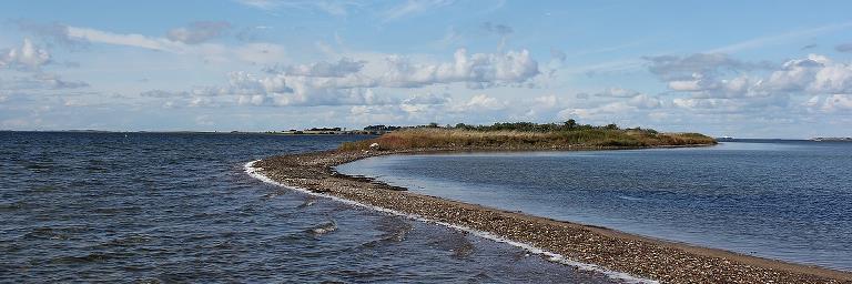
Nakskov Fjord Nature Park is surrounded by land to the north, south and east. To the west, the fjord is protected by the 2.7 km long Enehøje and the Albuetangen. Together with the many islands and islets, this creates an exceptionally protected waterway that benefits animals and people. However, Nakskov Fjord has changed a lot over time.

Nakskov Fjord is a so-called drowned moraine landscape. This means that hills in the flat landscape of the past have now become islands in Nakskov Fjord and the seabed was once land.
Ice and meltwater shaped the fjord
During the last ice age, ice formed a wide tunnel valley between Birket at Kragenæs and Nakskov. Where the water masses burst out at the ice edge, a violent ice age river flowed. This river formed a deep channel in Nakskov Fjord. We can follow the trench from Nakskov Harbour to Hestehovedet. From here it turns north and out between Slot and Vejlø towards Enehøje. The trench runs along Enehøje and turns sharply west at the southern tip of the island before finally disappearing into the Langeland Belt. This channel is used extensively by local sailors and the Post Boat. The locals call the channel the Old Run. Imagine that this was once a raging river with large chunks of ice between the waters.
When the ice was gone about 11,500 years ago, the land was open. Only herbs and low shrubs grew and the early glacial river became a stream in the flat landscape and the first Stone Age people who migrated up from the south could walk dry across the Langlands Belt. The landscape changed slowly, with forests gradually covering most of the land, leaving only open streams and rivers. From about 9,000 to 7,500 BC, the last large ice masses melted and water levels rose by 20-30 metres. This connected the Baltic Sea to the Kattegat and the water flowed quietly into Nakskov Fjord, forming much of the landscape we know today.
The great fjord became smaller
Nakskov Fjord, however, was much larger than it is today. Especially south of the fjord there was a large desert and southeast of Nakskov two large fjord arms went far inland. At that time, Nakskov Fjord contained about 20 large islands and small islets.
After the Great Flood of 1872, Nakskov Fjord was again significantly altered. In the 1870s, large-scale dike construction began along the entire south coast of Lolland, and Denmark's longest dike, 63 km long, was built. In Nakskov Fjord, a dyke was built from island to island to the maritime town of Nakskov, cutting away the two arms of the fjord.
Nakskov Fjord today
Today Nakskov Fjord is predominantly a shallow area. You don't have to go far from the shipping channels to find water depths of 1 - 1.5 metres or less. Particularly on the south side of the fjord, the area is divided into three large bays. Saunsø Vig is closest to the town. Then comes the wooded isthmus of Vejlø Skov, before Bogø Vig. The fjord is then broken by the old islands of Bogø and Langø before reaching Søndernor, which is protected by the Albuetangen. On the north side of the fjord there are also several shallow bays separated by the forests at Lindelse.
The many bays, coves and islets create an exceptionally beautiful and varied landscape and are an Eldorado for birds as well as for people in small dinghies, canoes and kayaks.
In fact, there are also several places where you can experience the former fjord, which is still quite exciting. Visit Avnede Strand, Lindelse or Det Forsvundne Ørige
